


-

Bynav Returns To XPONENTIAL UAV Expo USA
On April 23, Bynav Technology with hot products make the appearance at booth #4848 of XPONENTIAL 2024 in San Diego, USA.
-
Bynav makes an appearance at GCA 2024
At GCA 2024 , Bynav exhibited a series of products at the exhibition, including High-precision Positioning GNSS SoC, Multi-source Fusion Positioning Modules, Positioning Box, as well as GMouse RTK Antenna.
-
Bynav Secures Hundreds of millions Investment from Bosch Venture Capital, Great Wall Motors, Xinghang Capital, and Geely-affiliated Funds
Bynav Secures Hundreds of millions Investment from Bosch Venture Capital, Great Wall Motors, Xinghang Capital, and Geely-affiliated Funds.
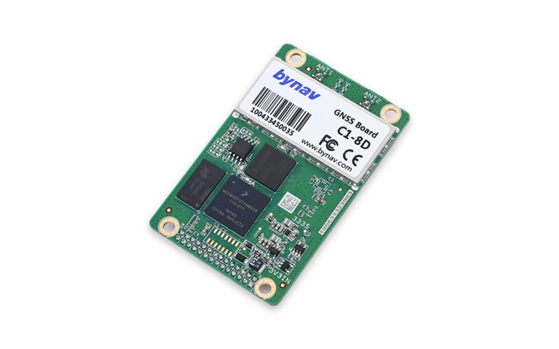
Features
- Based on Bynav GNSS Baseband ASIC Alita and RFIC Ripley.
- Support full-constellation, full-frequency RTK positioning and dual-antenna heading.
- Support modern signal systems such as BDS-3 and Galileo.
- Enhanced connection options including serial, CAN and Ethernet.
- Support GNSS/INS deeply coupled algorithm, raw data output and post processing.
- Support on-board TF card to back-up local data.
- Optimal performance in multipath mitigation, anti-interference and anti-blockage.
- Compact size and low power consumption.